Broom Junction to Stratford upon Avon (Click here for pdf document)
This was a single line railway which ran to the north of the river Avon. There were stations at Bidford and Binton.
The line opened to Stratford in 1879 and by 1892, it was to become part of the Stratford on Avon and Midland Junction Railway and ran for 55.5 miles from Olney in Buckinghamshire to Broom Junction where it joined the Evesham to Alcester line.
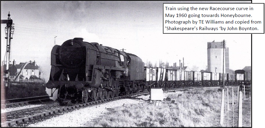
The line had an important use as a cross-country freight line, notably iron ore trains from Northamptonshire and banana trains from Avon mouth docks. For most of its history there was only a northbound chord leading to Broom junction and connecting to the Evesham to Alcester line. However, in World War II, the strategic importance of the line was recognised as a new connecting line was constructed so that trains from Stratford could turn directly on to the Alcester to Evesham line and proceed towards Evesham. The concrete signal box still to be seen from the A46 dual carriageway was built to control the new junction and remains to this day. See the section on Evesham to Alcester.
The SMJ Society
The SMJ Society is active in collecting information on the line. It has a website: www.smj.me
The website states: ‘The Stratford Upon Avon & Midland Junction Railway’ (or S.M.J.) was a small independent railway company which ran a line across the empty, untouched centre of England. It visited the counties of Northamptonshire, Warwickshire, Oxfordshire and a little of Buckinghamshire, only existing as the SMJ from 1909 to 1923. In 1923 the S.M.J became a minor arm of the London Midland and Scottish (L.M.S.), then in 1948 ‘British Railways. Gone but not forgotten: “the damsel is not dead, but sleepeth”.’
One of the principal sources of photographs is ‘The Stratford upon Avon and Midland Junction Railway, a pictorial survey by Stephen Thompson’ published in association with the SMJ Society. In 1961, Stephen set out in his E-type Jaguar and compiled a photographic survey of the railway, by then closed and becoming overgrown.
An excellent website is Warwickshire Railways, well laid out and with information easy to find: https://www.warwickshirerailways.com/lms/stratfordmidland.htm
Photographs: All photographs are credited, with the exception of those taken by Colin Tether.

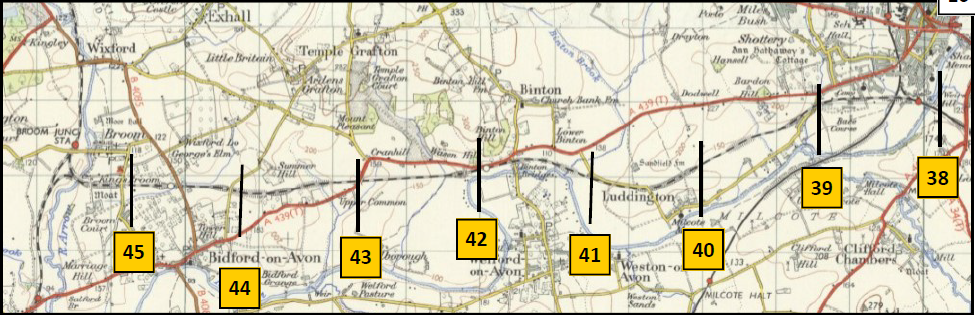
This map is copied with thanks from ’The Stratford & Midland Junction Railway’ by J. M. Dunn

What remains in 2020
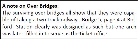
The following section is work in progress as not all of the line has been walked by the author. Therefore only some of the sections are covered in any detail. Note the bridge numbers shown are for easy reference only, they are not the original official numbers.
Surviving Structures
Although the line was closed in 1960, over sixty years later a surprising amount survives. The map above shows the bridges on the route of which at least seven are still in place. Bridge 3 carries a footpath, Bridge 4 carries a road, Bridge 6 carries a road, Bridge 8 and Bridge 11 carry footpaths. Nothing remains of Bidford station. At Binton station a stone building remains which has been incorporated into the new housing development.
Walking the route
In contrast to the Evesham to Alcester line, very little is followed by footpaths. Only just before Bridge 8 and between Bridge 12 and Bridge 13 are there a public rights of way along the line and the latter is now a shared walking and cycle route.

What remains in 2020 – Broom Junction to Bidford
This has been covered to some extent within the
Evesham to Alcester section of the website. Of the two chords leading off the main line from Evesham to Alcester, the southern one, opened in 1942 is much the easier to see as it is along a small embankment and still retains an accommodation bridge. (Bridge 1). Both chords joined just before the bridge over the river Arrow (Bridge 2), shown in the photograph on page 3. The abutments survive on both sides of the bridge.
If a replacement bridge were considered here a fairly simple structure would be possible as the river is not navigable and therefore only headroom would be required.

Surviving remnant of Bridge 2 structure on the east side of the river Arrow. There are similar remnants on the west side of the river

The wooden signal box in the photograph was only installed when the new chord upon which the train is travelling was installed. It is curious that the same type of construction was not chosen for new signal box the other end of the new chord where the new line joins the Evesham to Alcester line. That new signal box was of concrete construction, designed to withstand bombing.

After Bridge 2, there follows a section through a substantial cutting which can be walked to the road between Broom and Bidford. It is not a right of way but there is currently nothing to deter the walker. Where the cutting is at its deepest, a bridleway crosses the old railway using Bridge 3. At Bridge 4 the Broom to Bidford road is crossed. It is curious that the latter bridge was not demolished years ago and we are fortunate that it survives in a fairly good condition 60 years after the last train passed beneath.


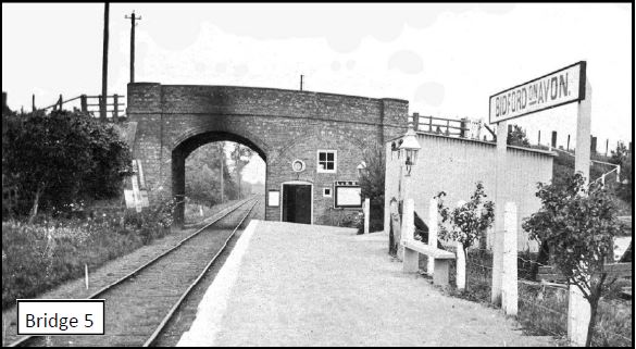
After the road bridge the old railway line ran alongside the side of a field and then into a shallow cutting. There is no formal path along this section, although the route is followed by people walking dogs. It is not possible to follow the line in the cutting due to brambles and scrub. After the cutting the line reaches Waterloo Road where the Bidford Station was located. Nothing seems to remain of the station and Bridge 5 which the road used to cross the railway is gone.
What remains—Bidford to Binton
After Bidford station, the course of the old railway line has been taken by Bidford Industrial Estate and this section has not been traced by the author. The line does re-appear in a wooded cutting just before 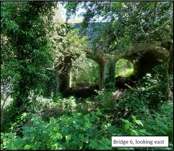 Grafton Lane. The section which can be seen here from Bridge 6 was under water in May 2021.
Bridge 6 is still in place taking the lane from Bidford to Temple Grafton. The bridge is in generally good condition but has left some coping stones. On the east side of the bridge the undergrowth looks very dense but representatives from Bidford Health Centre confirm it is possible to walk from Bridge 6 to the back of the Health Centre, a distance of nearly a kilometre.
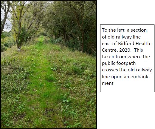
Beyond the Heath Centre the old line is crossed by a footpath and it can be clearly seen that the old railway line on an embankment remains and could easily be walked along.
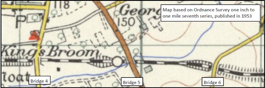


Next comes the main road between Bidford and Stratford. Bridge 7 (see map overleaf). This bridge used to take the main A439 over the railway. I can find no photographs of this bridge. Stephen Thompson did however take photographs from the bridge showing the single line railway in a very shallow cutting running straight either side of the bridge, shown below.
It can be seen that the railway ran in a very shallow cutting to the east of the bridge. This section from Bridge 7 to Bridge 8 is now inaccessible, but looking at the aerial photographs is probably largely unchanged except all the subsequent tree growth.


The course of the old railway line can be followed again at point X shown on the map to Bridge 8, where a public footpath runs along the south side of the old line.
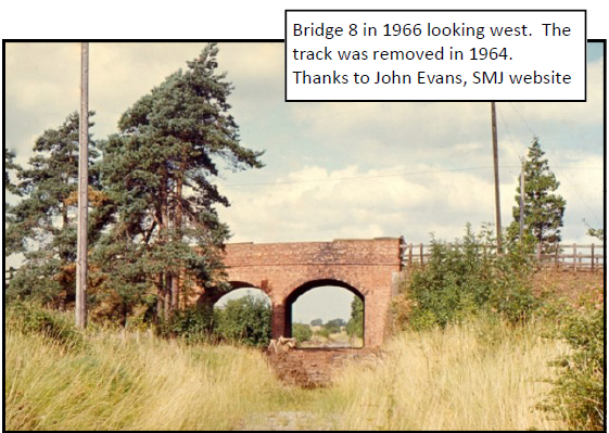
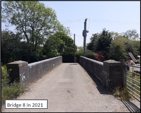
Here the line used to run in a deep cutting which has now been filled in and used as a farm housing building and equipment. However, there is a remarkable survival, bridge 8 that used to take the footpath and farm track over the railway. This now sits level with the ground either side but the structure is all there, most probably in good condition although most of it now well hidden below the ground.


What remains in 2020 – Binton to Stratford
Just after the station a new path follows the course
of the railway. In addition the old concrete gate posts
to the station yard still remain next to the A439.
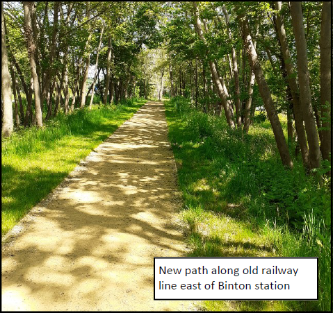
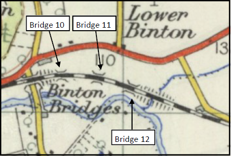

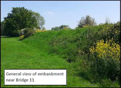
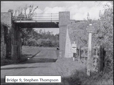


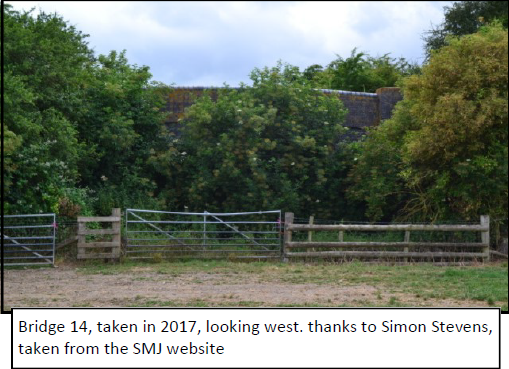
The line runs adjacent to the lane on a shallow embankment for about 500 metres and the formation can easily be seen amongst the trees and undergrowth. The road then takes a sharp right turn over the line of the railway where Bridge 13 has been removed. The old line continues as a wildlife wooded corridor until it reaches Bridge 14 where a public footpath crosses the line. It is understood that this bridge was to be removed but local pressure meant that it has remained.
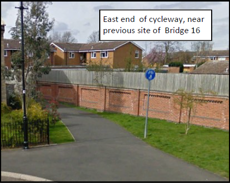

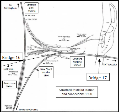
These two maps are from 1960 and 2020. They show how the road has taken over from the railway with Severn Meadows Road replacing railway lines. Severn Meadows Road crosses the river Avon using the bridge that was originally constructed for the railway. The map on the left from the Warwickshire railways website, on the right, Open StreetMap



Opening, Closing and Services
Stratford to Broom Junction opened to both passengers and goods on 2nd June 1879. The line was closed to passengers on 16th June 1947 and to goods on 13th June 1960. Generally there were four weekday passenger train each taking 20 minutes between Broom and Stratford. There was no Sunday service.
The End.
In 1958, the new ‘Racecourse’ chord was built just east of Stratford station which enabled trains coming from Blisworth to turn onto the line from Stratford to Honeybourne. This chord was not actually properly opened until 1960 but once it was the need for the Stratford to Broom effectively disappeared. The line was then closed to all traffic.